
Build an Old Bridge Street Trail
Use a street search as a chain of record checks, not as a list of households. First, standardize the mailing address with USPS. Then compare it with the Middlesex parcel layer, which supplies the municipal field, block, lot, PAMS PIN, property location, and other public parcel attributes. The County Clerk index can follow the parcel to recorded transfers. Planning files can add a dated development record. Old directories and newspapers can then place a household at an address in a stated year. Each link has a different meaning, so keep the source and date beside every fact.
- Run the address through the USPS ZIP Code Lookup. Keep the returned street spelling, postal city, ZIP, and ZIP+4 if USPS returns one.
- Query the Middlesex County parcel layer. Record its municipality, block, lot, qualifier, and PAMS PIN before drawing a conclusion from the postal city.
- Use the parcel ID, a deed book/page pointer, or a party name in the Middlesex Land Records index. A grantor or grantee is a recorded-party fact, not a current-occupancy finding.
- For a person's own registration question, use the New Jersey exact-name status route rather than treating a voter record as a street-browse tool. A status result can be inactive or protected.
- For a dated household question, ask the library or historical society for a criss-cross directory, newspaper, or Madison-era source. Preserve its printed date and page.
That order reduces false matches. It also leaves room for a parcel whose postal city differs from the municipality shown in county data. The Old Bridge street directory remains useful because it makes those differences visible.
Note: Preserve the normalized address and the parcel identifier separately because either can change while the other remains useful for historical research.
Separate Old Bridge Street Fields
Old Bridge Township addresses need four labels: municipal jurisdiction, postal city, ZIP, and parcel location. A South Amboy or Matawan mailing label does not settle whether a parcel lies in Old Bridge. The county parcel service provides the municipal field, while USPS confirms deliverable formatting. A street directory should preserve both results instead of forcing one label to replace the other. This matters at the waterfront, in western Route 516 areas, and wherever a postal overlay crosses a township line.
Start with the exact house number and street name. Add an apartment or unit only when it is already public and needed for the record at hand. The county layer's property-location field, its municipality, block, lot, and ZIP provide a more reliable geographic trail than an assumed neighborhood name. For a subdivision change, older block, lot, qualifier, and additional-lot fields can be helpful bridges. They are clues that should be confirmed with a deed, map, or planning file.
- Parcel
- A mapped unit of land identified in the county system by fields such as municipality, block, lot, and PAMS PIN.
- Situs address
- The property-location address used to identify the place on a record. It can differ from an owner's mailing address.
- Plat
- A recorded map that can show lots, boundaries, or a subdivision layout. The county land index has a map-number search path.
- Criss-cross directory
- An address-arranged directory, often organized by street and house number, used to locate a dated printed listing.
Note: A ZIP code is a postal overlay, while the municipality and parcel geometry are the better checks for Old Bridge jurisdiction.
Read Old Bridge Street Parcels
The public Middlesex parcel service is the strongest address-keyed starting point in this street directory. Its field inventory includes PAMS PIN, municipality, block, lot, qualifier, property location, property class, land description, ZIP code, old block/lot/qualifier, additional lots, deed book/page, sale date, sale price, acreage, year built, SFLA, tax, and update fields. County GIS publishes the underlying geodatabase information, and NJGIN explains that parcel data can be searched by address, county, municipality, block, and lot.
Not every field will appear for every parcel, and public owner information can be redacted under Daniel's Law. A blank owner field is not a gap to fill with another source. Use the publicly displayed property location and parcel identity for a street-level trail, then use a recorded document or a public agency response only when it is appropriate for the specific question.
See the NJGIN parcel guidance shown below. It is a useful reminder that parcel edges may not match cleanly across county boundaries and that protected owner names can be suppressed.
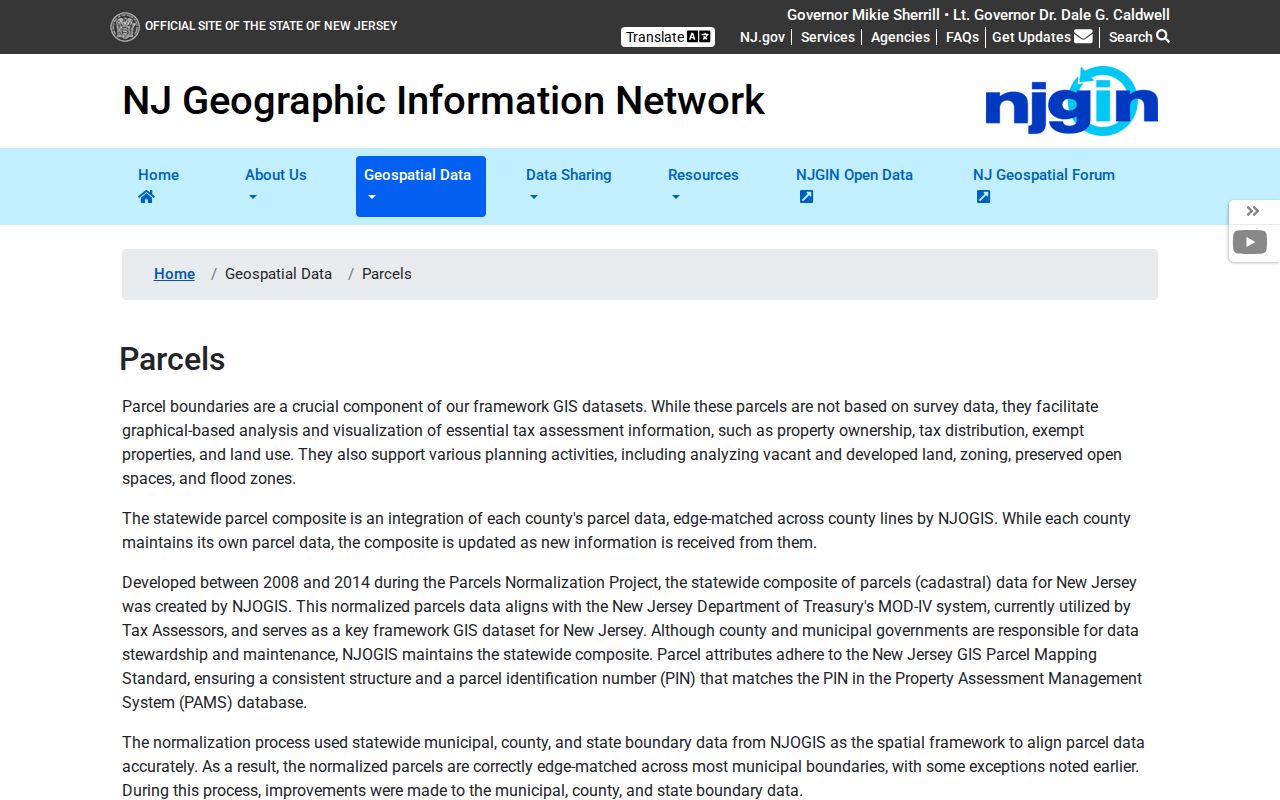
The Old Bridge street directory uses this layer for parcel identity and geography, not for a claim about who currently occupies a property.
Check Old Bridge Street GIS
The county FeatureServer is a public service rather than a simple township name search. Address research works best when the input is narrowed to a property location, then checked against the returned municipality and parcel attributes. The table below records the fields the research found in the parcel layer. It does not claim that every field is visible for every result or that the Old Bridge Tax Assessor page itself offers a public parcel-search form.
| Field or filter | Type | Required | Old Bridge use |
|---|---|---|---|
| Property location | Parcel attribute | No | Matches the address to the mapped property. |
| Municipality | Parcel attribute | No | Confirms the Old Bridge Township geography. |
| Block, lot, qualifier | Parcel identity | No | Connects a location to deeds, maps, and assessment work. |
| PAMS PIN | Parcel identity | No | Stable county parcel pointer for a record trail. |
| Deed book/page | History pointer | No | Leads to a county land-record follow-up. |
| ZIP code | Postal attribute | No | Checks the parcel label against USPS, not jurisdiction alone. |
The official Old Bridge Tax Assessor page identifies the municipal assessment route, but the current research did not find a public search interface or field inventory there. Use the county parcel service for the documented field set and direct parcel-specific assessment questions to the township assessor or tax office.
The assessor landing page below is a useful routing screen, not evidence of an online owner lookup.
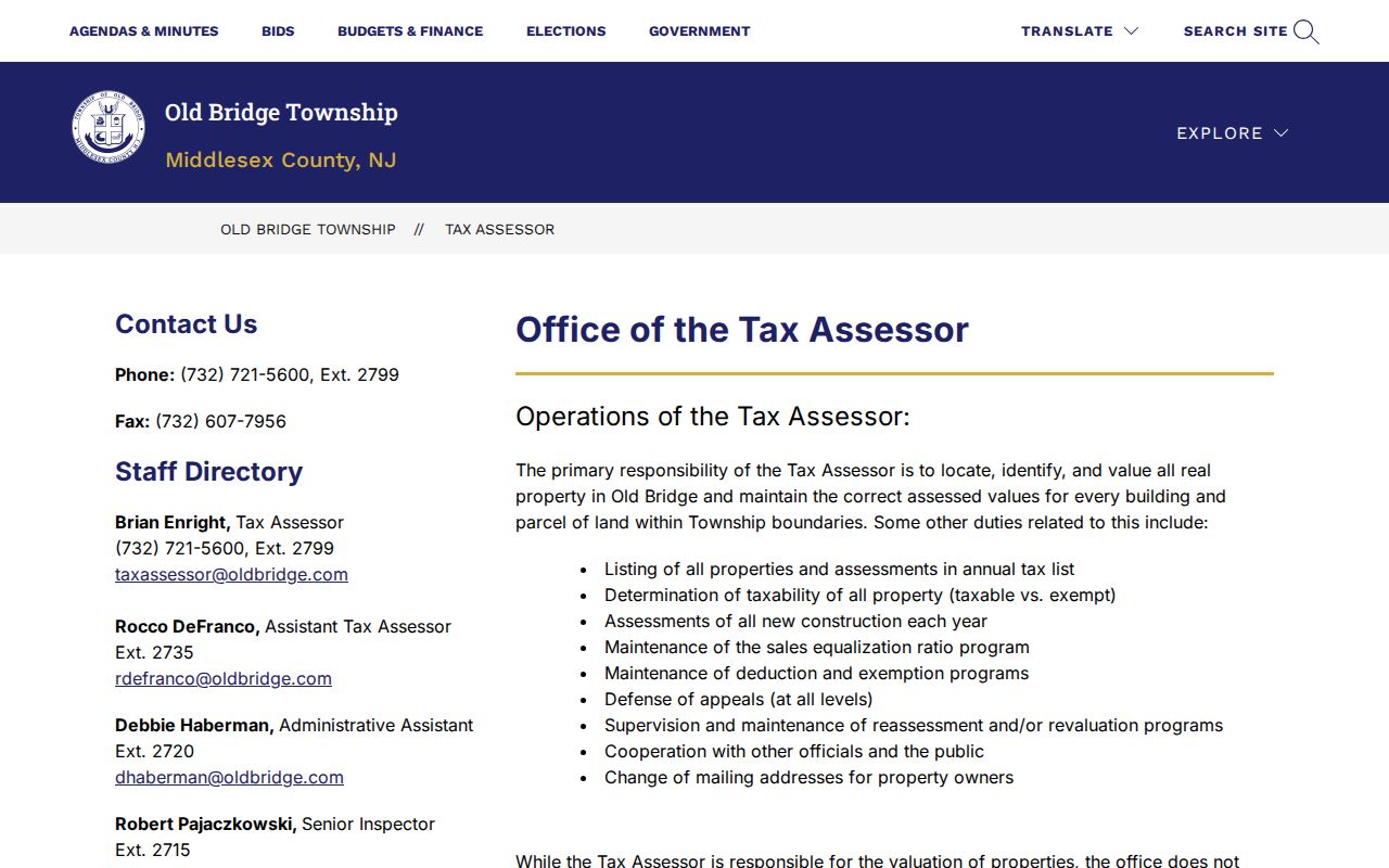
When a field is missing or redacted, retain the public parcel facts already available rather than trying to reconstruct protected personal information.
Follow Old Bridge Street Deeds
The Middlesex County Clerk maintains real-property ownership and transfer records, and the public index offers Document Types, Name, Instrument Number, Map Number, and Parcel ID search paths. Document-type searching can be narrowed by town, consideration amount, and date range. Name searching includes property type and dates, while the number searches use a number field and date range. The index uses a reCAPTCHA and may show a party marker, details, print results, or no records. Start with a parcel pointer when one is available, then retain the instrument number as the stable citation.
County guidance says deeds from 1929 forward, mortgages from 1950 forward, and other listed documents from 1958 forward are viewable or printable online. A county digitization announcement reports deed access back to 1923. Those statements conflict, so the street directory treats 1923 as a possible earlier range and asks the reader to verify a particular deed in the live index or record room. The public record room is at the County Clerk's Recording Services office, 75 Bayard Street, fourth floor, New Brunswick. Staff can explain the computerized system but cannot conduct a title search.
The Middlesex Land Records search has the documented tabs and date controls shown here.
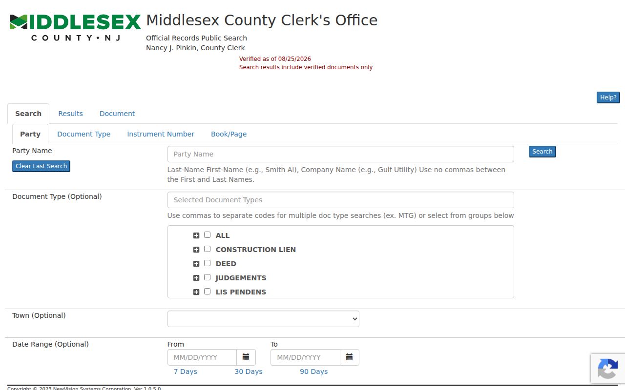
A deed index result can establish a recorded party and transaction trail. It does not, by itself, prove current ownership, occupancy, boundary position, or a complete chain of title.
Note: Check the current County Clerk fee schedule before ordering a copy because the research found differing simplified fee descriptions.
Find Old Bridge Street Files
Address-keyed municipal material can explain a street's development without becoming a household roster. The Old Bridge Planning Department makes development applications, Planning Board and Zoning Board minutes and proceedings, master plans, the land-development ordinance, zoning map, and administrative files available for public viewing. A focused request should give the address, block and lot if known, application type, board, year range, and the item sought, such as a resolution, plan set, meeting minute, notice, or correspondence.
Old Bridge's permit portal has public New Application, View Applications, and Instructions paths, including planning, zoning, engineering road-opening, certified-property-owner, tree-removal, and Clerk categories. The research did not confirm individual field labels, fee schedules, or a searchable public application index. Code Enforcement also routes property-maintenance and zoning matters, but complaint files can contain protected details. Ask for a defined record type and date range, not a sweeping personal file.
For a street-history question, combine an application date with the parcel's old block/lot fields, a recorded map, and county aerial photography. Middlesex has aerial images for 1962, 1967, 1974, 1980, 1987, and 1998. The images document physical change, not who lived on the street.
Compare Old Bridge Street Records
Several Old Bridge sources can be keyed to the same address, yet they have very different limits. This street directory coverage table keeps the source role clear. Use it to choose the next record, not to merge every fact into a single claim about a household.
| Address record | Custodian | Street-level value | Access route |
|---|---|---|---|
| USPS address result | USPS | Standardized mailing address, postal city, ZIP, ZIP+4 when returned. | Public address or city/ZIP lookup. |
| Parcel layer | Middlesex County GIS | Parcel location, municipality, block, lot, PAMS PIN, and public attributes. | Public FeatureServer and county GIS resources. |
| Land record index | Middlesex County Clerk | Recorded parties, instrument, book/page, date, consideration, and legal description. | Public index, record room, or copy route. |
| Planning or permit file | Old Bridge departments | Application, board date, plan reference, decision, or development context. | Department viewing, portal, or specific OPRA request. |
| Directory or newspaper | Library, archive, historical institutions | Dated printed name, street/number, organization, or historical context. | Collection request or digitized archive. |
| Voter status | NJ and Middlesex election offices | Self-service registration status context for the person checking their own record. | Exact-name status route; protected and inactive rules apply. |
The most reliable trail preserves contradictions. A dated directory entry may show a historical household, while a later deed reflects a transfer and the parcel map reflects current geography. None erases the others.
Search Old Bridge Streets as Madison
Old Bridge street research has a local naming issue. The township used Madison Township from 1869 until the 1975 referendum/name transition according to official history. The Thomas Warne Museum describes the change as 1976. That one-year discrepancy should stay visible in a research log. Search Madison Township, Madison, Old Bridge, and South Amboy Township when a street, family, deed, or newspaper hit appears to end abruptly.
The Old Bridge digital archive has Newspapers and Documents categories with local titles, clippings, and special editions dating to the early 1900s. Search a surname fragment, street number, institution, or alternate township name, then inspect the image because exact title-by-title date runs and OCR quality were not confirmed. For fuller local context, the Thomas Warne Museum and Library supports historical and genealogical research by appointment and on Saturday afternoons.
This is the historical handoff point. A reader tracing printed address listings across years can use the Old Bridge historical directory collections, while the street directory remains focused on the address-keyed record chain.
Map Old Bridge Street Geography
County GIS is especially useful when a named street meets a postal or municipal edge. The county service distinguishes the parcel municipality from a ZIP label, and NJGIN cautions that parcel boundaries may not edge-match adjacent counties. For Old Bridge, that distinction matters where township addresses use Parlin, Laurence Harbor, South Amboy, Cliffwood Beach, Keyport, or Matawan postal naming. A street name alone does not resolve the geography.
The Middlesex GIS parcel service exposes its parcel field list and query capability below.
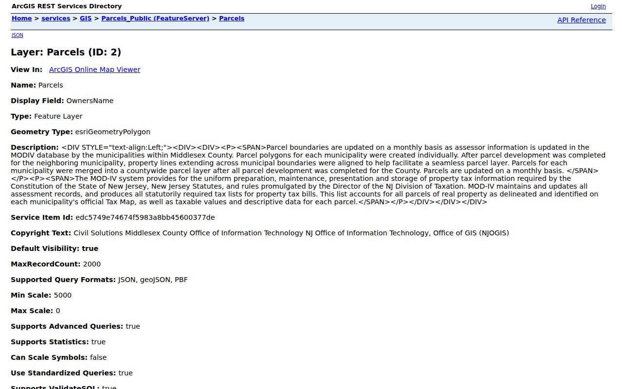
Use municipal geography and parcel identity for an Old Bridge street trail, then use USPS to validate how mail is addressed.
Limit an Old Bridge Street Search
A street directory cannot supply a complete current list of people at an address. A parcel result may omit owner data, a deed can name a former owner, a voter record can be inactive or protected, and an old directory is tied to its publication date. New Jersey OPRA redactions also protect sensitive identifiers, signatures, unlisted telephone numbers, victim information, and protected official addresses. Do not treat blank fields as an invitation to infer private facts.
The New Jersey Address Confidentiality Program provides a substitute address for qualifying participants, while Daniel's Law can suppress protected officials' information in public map and tax services. If a public source appears to reveal protected information, stop redistribution and use the official reporting or suppression route.
Note: Record the source, record date, and the exact fact shown so a historical listing is never presented as a current residence claim.